History Of Kiltarnet
- Six
inch Ordnance survey map.
- Archeological
survey map.
- O'Donavan's
Ordnance Survey letters.
- Tithes
Applotment (1835).
- Sale
in Encumbered Estates Court (1852).
- Griffith's
Valuation (1857).
- Comparison
of Tithes and Griffiths.
- Summary
Censuses of 1841 - 1891.
- 1901
Census.
- 1911
Census.
- Baptism
registers
- Birth
registrations.
- Marriage
Registrations
- Valuation Office Entries
- Gravestone
Inscriptions.
- Photographs
of houses (occupied and unoccupied in the townland).
- Old
photographs of previous occupants.
- Interviews
with present occupants.
- Family
trees.
- Some
references to Kiltarnet
- Landholders
in 2003
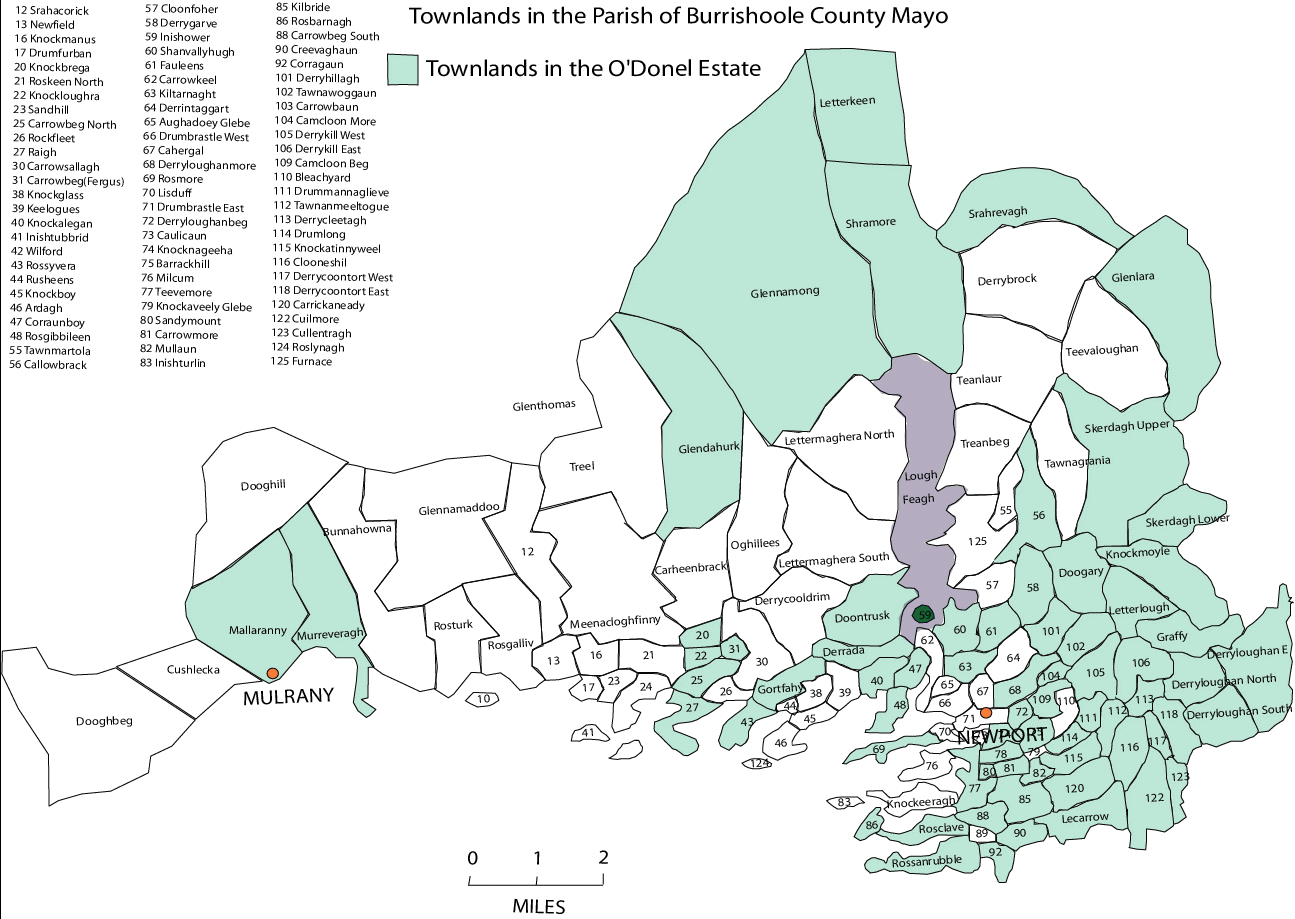
Move the mouse over the townland
of Kiltarnet on the map and click to see and enlarged view.
Introduction | County
Library | Dublin Sources | Internet
| Mapping | Photography
| Scanning | Oral History
| Family Tree | Archeology
| Purpose of Website |
Website Map| Manual | Kiltarnet | Links
|